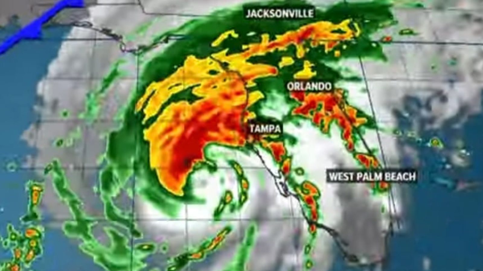
The Sunshine State has already witnessed devastation from Hurricane Helene and is bracing for the impact of Hurricane Milton.
Milton is projected to be among the most powerful storms in recorded history.
Some analysts have dubbed Milton the ‘Storm of the Century.’
“Hurricane Milton approached known maximum storm strength limits on Monday night, with wind gusts briefly topping 200 miles per hour,” the New York Post reports.
The gargantuan strength of Milton prompted some experts to call for a Category 6 designation.
New: Hurricane Milton has the potential to reach max limits. This is leading to calls for a new Category 6 designation for hurricanes.
Via: The New York Post pic.twitter.com/ftH1DmGnAS
— The Calvin Coolidge Project (@TheCalvinCooli1) October 8, 2024
“This is nothing short of astronomical,” Florida meteorologist Noah Bergren said, according to the New York Post.
“I am at a loss for words to meteorologically describe to you the storm’s small eye and intensity,” he added.
From the New York Post:
After forming as a Category 5 storm, Milton on Tuesday was downgraded to a Category 4 after hitting Mexico’s Yucatan Peninsula with a glancing blow. By Tuesday night, it was back to Category 5 again as it churned toward Florida’s gulf coast, putting millions of lives at risk.
After forming in the Gulf of Mexico, Milton rapidly accelerated from a tropical storm with 60-mph winds Sunday morning to a deadly Category 5 hurricane by Monday with sustained winds of 180 mph — exhibiting an incredible trebling of power in only 36 hours.
If the hurricane reached winds of 192 mph, it would have surpassed a rare threshold that just five storms have reached since 1980, USA Today reported.
Its exceptional intensity has prompted calls from some meteorologists to expand the Saffir-Simpson Hurricane Wind Scale to include a new Category 6 for hurricanes.
Now, Florida may have to prepare for another tropical system after Milton passes through the state.
The U.S. National Hurricane Center identified a potentially developing storm that would be named ‘Nadine.’
Is this real??
Another gulf hurricane (Nadine) 7 days after Milton?
pic.twitter.com/4r7sijADyo
—
Kelli Kay
(@KelliKayK) October 8, 2024
It just don’t stop
Another potential hurricane ‘Nadine’ might be headed towards Florida pic.twitter.com/kwEQ3REpnk
— Vision4theBlind (@Vision4theBlind) October 9, 2024
Per Daily Mail:
The current ‘non-tropical area of low pressure,’ NHC officials noted, is currently ‘producing gale-force winds’ northeast of the Bahamas at 15 miles per hour.
Right now, this weather front has a 20 percent chance of building into a tropical storm and could develop into a stronger hurricane-force storm before Wednesday night — just as Milton barrels over Florida.
NHC officials described Hurricane Milton as already ‘potentially catastrophic’ for Florida’s western coastal communities all by itself — a clear indication that yet another storm this soon would do unprecedented harm.
Potential hurricane ‘Nadine’ is on a path to hit Florida in Milton’s wake https://t.co/Ao6QpkQUZH pic.twitter.com/jCsqzQX1iM
— Daily Mail Online (@MailOnline) October 8, 2024
FOX Weather reports:
While all eyes are on Florida’s western coast ahead of Hurricane Milton’s arrival, something could be brewing on the east side of the Peninsula.
The National Hurricane Center outlined an area for possible tropical development off the southeast coast of Florida, now designating the disturbance Invest 93L.
The area currently has a low chance of tropical development over the next 48 hours, and timing will be critical to whether anything forms.
ADVERTISEMENT
This is a Guest Post from our friends over at 100 Percent Fed Up.


Join the conversation!
Please share your thoughts about this article below. We value your opinions, and would love to see you add to the discussion!